

Right to mobility
An essential factor for individual and collective development, ensuring people's ability to travel safely, efficiently, and accessibly.
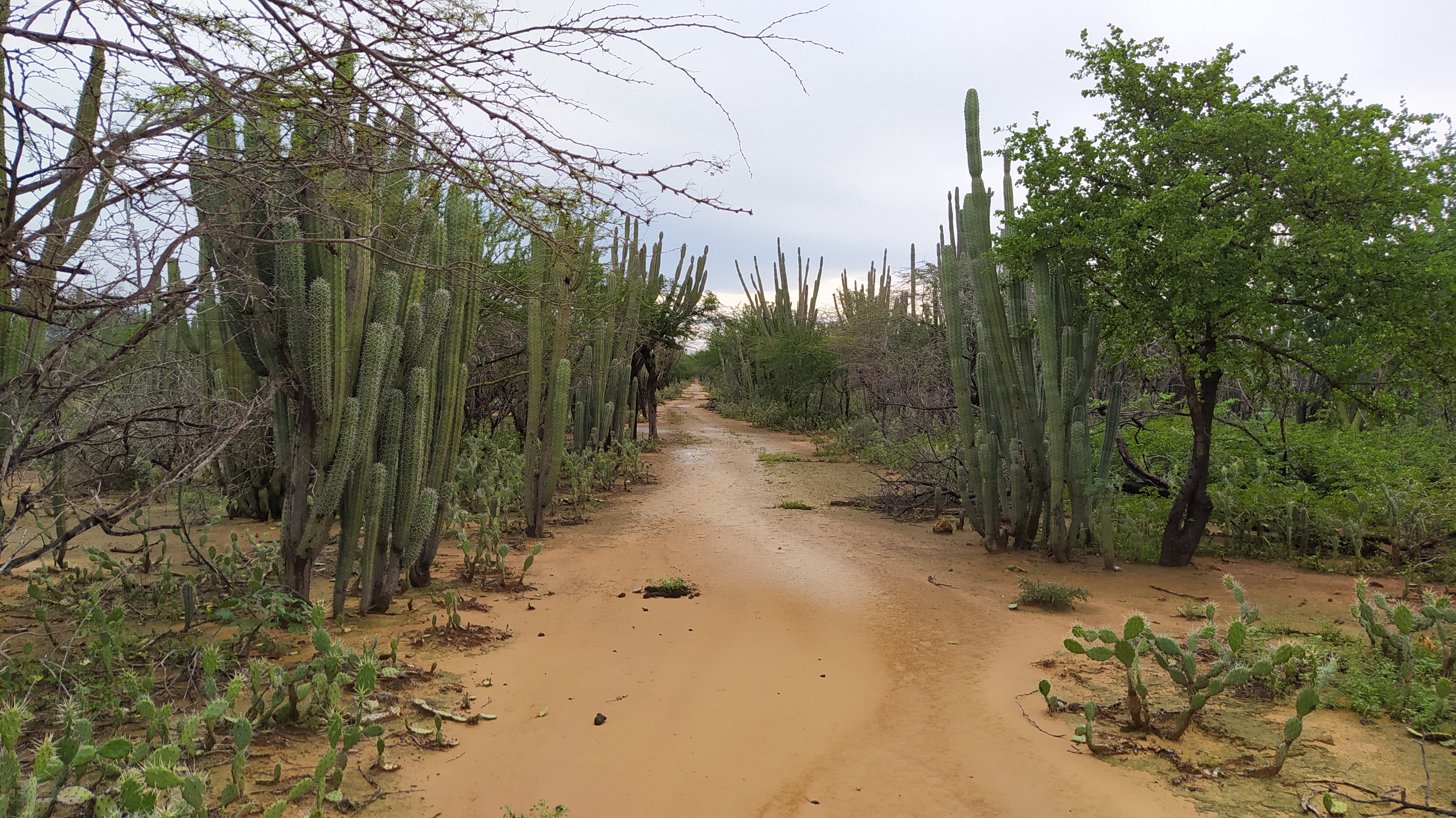
Find information here about the road infrastructure that facilitates access to mobility, a fundamental human right that has been the focus of special attention due to the humanitarian crisis facing the Wayúu indigenous people in La Guajira.
We answer your questions
-
A characterized or inventoried road is one that has undergone a visual inspection of both its cross section and its elements, such as bridges, walls, and drainage works. Therefore, it is a detailed record of the physical, geometric, and operational characteristics, represented by georeferenced geographic information. This process allows for a diagnosis of the road infrastructure, thus providing reliable information for planning, maintenance, and effective decision-making in road infrastructure and mobility projects.
-
These are minor, specific works that address critical sites. These interventions, in turn, translate into improvements and fluidity in the passability of the entire corridor, reducing the risk of accidents or emergency situations, minimizing road service interruptions, prolonging the useful life of the infrastructure, and contributing to the social and economic development of the communities that inhabit the road area. n Intervention on tertiary road sections is vitally important because it improves traffic flow and direct access to communities, positively impacting their development. A road in good condition reduces transportation times and costs, facilitates the entry of humanitarian aid and basic services, and allows the population to move more safely to access economic and social opportunities.
-
The inventory or characterization of roads in the SINC defines important aspects such as the length, jurisdiction, and category of roads, operational aspects such as the number of lanes, types of surface, conditions, as well as the identification of important elements of the road network such as the existence of bridges, drainage works, walls, and critical sites. For more information, see the following link.
-
To understand what a road intervention is, it is necessary to understand several fundamental technical concepts. These include: critical site, which is the point where problems affecting traffic flow occur; subgrade, which is the natural base of the ground on which the road is built; drainage works, which allow water to pass through and prevent flooding; embankments, which are fillings necessary to level the road. These concepts are important because they explain the causes of deterioration of a road corridor and the type of technical solutions required to improve it. Understanding them allows us to understand that an intervention is not just “fixing the road,” but rather applying specific works that guarantee the safety, functionality, and durability of the road corridor. For more information, see the Response Auto 505 of 2025 Mobility Sector VF.
-
The Provisional Action Plan on the right to mobility has two (2) actions:
- Road characterization that contributes to the execution of works to improve the mobility conditions of the Wayúu people living in scattered rural areas (2 phases). Responsible: Ministry of Transportation (Resources) and municipalities of Maicao, Manaure, Uribia, and Riohacha (approves inventoried lengths). Km to be characterized: 2,488.66. Responsible parties: INVIAS and municipalities (Maicao, Manaure, Uribia, and Riohacha).
-
The Constitutional Court, through Order 505 of 2025, urges the Mobility sector to move forward with the completion of the actions that make up the Provisional Action Plan, approved by said Corporation through Order 311 of 2024. To this end, it grants a period of six (6) months, during which significant progress must be demonstrated in the interventions on the road sections included in the aforementioned plan, taking into account that these actions are aimed at improving the mobility conditions of the Wayuu communities located in remote areas. In this regard, the Court requests the submission of a detailed report on the progress made and, if the road intervention goals ordered are not met, the Mobility sector must submit a technical report that comprehensively justifies such non-compliance. It also orders the consolidation and presentation of a Structural Action Plan, setting the date for this as the beginning of 2026. For more information, see the Response Auto 505 of 2025 Mobility Sector VF.
Entities that make up the Mobility Committee
Mobility, a key right for the Wayúu Indigenous People
Learn more about rights and their enforcement
Sajuut tü awarairawaa
Akuaaipa choujasüü süpüla sainnu'in wane waneewai otta kajuuya'in, achechennusü süpüla waraituijatuin wayukana suka anaa'in akuaipa
Pünta süna'in yaya suchikumaajatü tü sukumajia tü kemionpaanaka apuinjatka wane waraitaa sumuin Wayuu, choujasuu naamuin süpüla naachajain kalinña suma tü kasa waima alatakat naamuìn yaa sulu'u tü noumainka yaa Wajir'a.
Entidades que conforman el Comité Técnico de Movilidad
Awarairawaa: Wane apansaja sujuutia Wayuu
Puchajaa saamuin tu lotookot akuaipa ottaa shikeraajia
Derecho a la movilidad
Factor esencial para el desarrollo individual y colectivo, garantizando la capacidad de las personas para desplazarse de manera segura, eficiente y accesible.
Encuentre aquí información sobre la infraestructura de vías que facilitan el acceso a la movilidad, un derecho humano fundamental que ha sido objeto de especial atención debido a la crisis humanitaria que enfrenta el pueblo indígena Wayúu en La Guajira.
Resolvemos sus dudas
-
Una vía caracterizada o inventariada es aquella en la que se ha realizado una inspección visual, tanto de la sección transversal como de sus elementos; como puentes, muros y obras de drenaje. Por lo tanto, es un registro detallado de las características físicas, geométricas y operacionales, representado mediante información geográfica georreferenciada. Este proceso permite hacer un diagnóstico de la infraestructura vial, y de esta forma contar con información confiable para planificación, mantenimiento y la toma de decisiones efectivas en proyectos de infraestructura vial y movilidad.
-
Son obras menores y específicas que atienden sitios críticos. Estas intervenciones, a su vez, se traducen en mejoras y fluides en la transitabilidad de todo el corredor reduciendo riesgos de accidentes o situaciones de emergencia, minimiza interrupciones del servicio vial, prolonga la vida útil de la infraestructura y contribuye al desarrollo social y económico de las comunidades que habitan en el área de la vía. La intervención en los tramos viales terciarios es de vital importancia porque mejora la transitabilidad y el acceso directo a las comunidades, impactando positivamente en su desarrollo. Un camino en buen estado reduce los tiempos y costos de transporte, facilita la entrada de ayudas humanitarias y servicios básicos, y permite a la población movilizarse con mayor seguridad para acceder a oportunidades económicas y sociales.
-
El inventario o caracterización vial en el SINC, define aspectos importantes como la longitud, competencia y categoría de las vías, aspectos operativos cómo la cantidad de carriles, tipos de superficie, estados, así como la identificación de elementos importantes de la malla vial como la existencia de puentes, obras de drenaje, muros, y sitios críticos. Para mayor información, consulta el siguiente enlace.
-
Para comprender qué es una intervención vial, es necesario conocer varios conceptos técnicos fundamentales. Entre ellos se encuentran: sitio crítico, que es el punto donde se presentan problemas que afectan la transitabilidad; subrasante, que es la base natural del terreno sobre la cual se construye la vía; obras de drenaje, que permiten el paso del agua y evitan inundaciones; terraplenes, que son rellenos necesarios para nivelar la vía. Estos conceptos son importantes porque explican las causas del deterioro de un corredor vial y el tipo de soluciones técnicas requeridas para mejorarlo. Comprenderlos permite entender que una intervención no es solo “arreglar la vía”, sino aplicar obras específicas que garantizan seguridad, funcionalidad y durabilidad del corredor vial. Para mayor información, consulta la Respuesta Auto 505 de 2025 Sector movilidad VF.
-
El Plan de Acción Provisional derecho a la movilidad, cuenta con dos (2) acciones:
- Caracterización vial que contribuya a la ejecución de obras para lograr el mejoramiento de las condiciones de movilidad del pueblo Wayúu que residen en zonas rurales dispersas (2 Fases). Responsable Ministerio de Transporte (Recursos) y municipios de Maicao, Manaure, Uribia y Riohacha (aprueba longitudes inventariadas). Km por Caracterizar: 2.488,66.
- Ejecutar obras para lograr el mejoramiento de las condiciones de movilidad de las comunidades Wayuu que residen en zonas rurales dispersas, del plan de acción provisional concertado con la comunidad Wayuu en el marco del cumplimiento de lo ordenado en la Sentencia T-302 La Guajira. Responsable INVIAS y municipios (Maicao, Manaure, Uribia y Riohacha).
-
La Corte Constitucional, mediante el Auto 505 de 2025, conmina al sector Movilidad a avanzar en la culminación de las acciones que integran el Plan de Acción Provisional, aprobado por dicha Corporación a través del Auto 311 de 2024. Para ello otorga un plazo de seis (6) meses, durante el cual debe evidenciarse un avance significativo en las intervenciones de los tramos viales incluidos en el mencionado plan, teniendo en cuenta que estas acciones están orientadas a mejorar las condiciones de movilidad de las comunidades Wayuu ubicadas en zonas apartadas. En esta línea, la Corte solicita la entrega de un informe detallado sobre los avances alcanzados y, en caso de no cumplirse las metas de intervención vial ordenadas, el sector Movilidad deberá presentar un informe técnico que justifique de manera integral dicho incumplimiento. Así mismo, ordena la consolidación y presentación de un Plan de Acción Estructural, estableciendo como fecha para ello el inicio del año 2026. Para mayor información, consulta la Respuesta Auto 505 de 2025 Sector movilidad VF.